

The Mysteries of The Bimini Road: Ancient, Underwater… & Artificial?
Top Image: If the Bimini Road is artificial it would be startlingly old, but most researchers believe the structure is naturally occurring.
By: Kurt Readman | Historic Mysteries
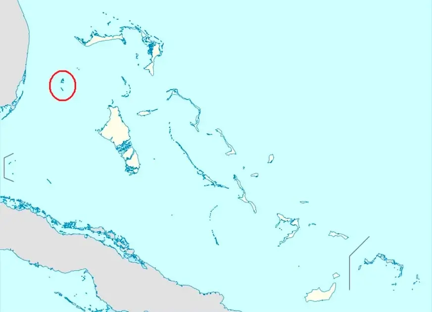
The Bimini Road, often referred to as the Bimini Wall, is an underwater rock formation near Bimini Island in the Bahamas. It is around 0.8km (half a mile) long and runs from the northeast to the southwest in a linear fashion.
It looks to have been composed of roughly rectangular limestone rocks and resembles a pavement when looked at from atop. Because, despite its location, the Bimini Road looks like nothing so much as a man-made thoroughfare.
Some believe that this formation is evidence of Atlantis and its sinking, whilst many geologists and archaeologists claim it is just natural. Whilst observing the feature, it is hard not to see it as a wall, road, breakwater, or pier.
However, there is little to no credible evidence that it exists through Atlantean design. As with many people who believe the Greek mythological explanation of Atlantis, people will argue that this is just the evidence that is required. However, is it an underwater passage to Atlantis or just a formation of rocks?
Discovery
In 1968 on September 2nd, Joseph Valentine, Jacques Mayol, and Robert Angove came across a structure that they described as a pavement while diving in only 18 feet (5.5m) of water in the Bahamas. The stones they saw were noticeably rounded and of varying size and thickness and ran from northeast to southwest.
This is what became to be known as the Bimini Road. Running parallel to this ‘road’ were two similar linear features which were also made up of tabular, flat-lying rocks.
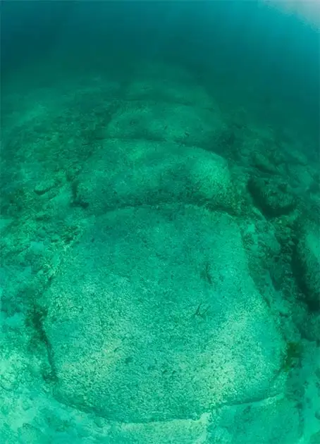
There have been many descriptions of this road each exaggerating the regularity and the shape of these stones. What is clear is that the Bimini Road runs for around 0.8km (0.5 miles) before curving into a hook at its southwest end.
The rocks themselves measure around 3-4 meters (10 to 13 feet) horizontally but lack any sign that they were cut by man-made objects. The smaller features running parallel to the Bimini Road only run around 50-60m (165 to 200 feet) and consist of stones only around 1-2m (3 to 7 feet) horizontally. One writer has described the rounded edges of these blocks as making the stones resemble loaves of bread.
The rock itself is made of limestone mixed with shell hash, which is known as Beachrock, native to the Bahamas. The rounded nature of the rock shows that a large amount of the rock has been eroded by biological processes. The amount that these stones have been eroded has left many geologists and archaeologists to conclude that it is highly unlikely that any surface features like tool marks or inscriptions would have survived.
Observations of the site claim that more rocks could be seen when the sand had washed away which also ran alongside the Bimini Road and that there was a second layer of them underneath. However, these findings have never been published in an accredited journal as they have always failed the critical evaluation criteria.
Pictures have appeared online showing man-made wedge stones and prop stones, but these are unlikely because of their small size and lack of regularity. It resembles no road that has ever been made by man. In order to help come to a conclusion about this many scientists have taken samples to help date the feature.
Age & Origin
Various techniques have been used in an attempt to get an accurate date for the stones. Of the most popular, radiocarbon dating, and uranium-thorium dating have been used.
Due to the fact that there were shells embedded into the rock, the shells dated older than the rock. The shells gave a date of around 3,500 years old. This means that they were from the fourth millennium BC. Other date markers from the rock gave a date of around 2,800 years old, placing it in the third millennium BC.
The “cement” that held the rocks together, however, returned a date of around 4,100 years old placing it in the 5th millennium BC. All of this evidence has led to the conclusion that the Bimini Road formed over time naturally and was only exposed in its current form due to coastal erosion over time.
There have been some debates regarding these dates. Some argue that the dates are not accurate because they came from whole-rock samples and thus were subject to carbon contamination.
However, this was not the case with the samples taken by Calvert in the late 70s. The dating acquired by the Uranium-Thorium has been declared invalid and thus is rarely used by geologists and archaeologists.
This is because the limestone the sample was taken from was not a closed system and so it became contaminated, and the sea level was different when the rock was formed compared to when the sample was taken. The samples used for this dating were above sea level when the formation happened. Thus, they are invalid.
Despite much of the evidence pointing towards a geological origin, there are still some that believe that the Bimini Road forms the remains of an ancient road. However, the evidence for this seems to be non-existent.
.png)
Other than a few articles claiming that these rocks definitely were cut by people, they provide no evidence of how or why. Many who have seen it just refer to the layer of horizontal blocks but do not argue to sway people when it is pointed out that multiple layers of rock can be naturally created by fracturing of sedimentary rock repeatedly by nature. This can be seen elsewhere, such as with the “pavement” found at Eaglehawk Neck near Tasmania.
Another theory, by Gavin Menzies, claimed in both his book and his documentary, 1421: the year China discovered America, that the Bimini Road was created by Chinese Admiral Zheng He. Menzies claims that when Zheng He was circumnavigating the globe in the 1420s that he stopped at Bimini but was caught in a huge hurricane.
In order to free his fleet, they built the Bimini Road from beach rock and the ship’s ballast as a way to haul all of the damaged goods ashore so that they could refit and repair the damages. However, this theory again holds no real evidence to support it, leading many to settle for the theory that it is a natural geological feature.
* * *
NEXT UP!
Ancient Egyptian Mummification Process Revealed (Video)
Unveiling the secrets of ancient Egyptian mummification, a fusion of millennia-old rituals and modern medical science has emerged. Egyptologists are utilizing cutting-edge technology to virtually unwrap mummies, preserving these time-honoured relics without physical harm.
The meticulous process of mummification, aimed at ensuring a prosperous afterlife, involved the removal of internal organs, preservation with natron, and elaborate wrapping ceremonies. The amulets placed within the layers of linen held profound significance, intricately tied to the beliefs detailed in the “Book of the Dead.”
This sacred text, a guide to navigating the perilous journey to the afterlife, played a pivotal role in ancient Egyptian spirituality. A quest for immortality, the “Book of the Dead” was not only a spiritual compass but also a status symbol, with priests assisting in the selection of spells tailored to individual needs.
* * *
READ MORE: The Phantom Wolf & The Haunting of The Hexham Heads
The UNEXPLAINED! U-Boat 85 & The Sea Monster: Terror From The Deep
Telegram: Stay connected and get the latest updates by following us on Telegram!
We’d love to hear from you! If you have a comment about this article or if you have a tip for a future Collective Spark Story please let us know below in the comment section.