
Linda Moulton Howe Reveals What Was Discovered in Antarctica — And It’s Disturbing!
Antarctica’s hidden landscape reveals radar anomalies, buried lakes, and debated interpretations that continue to blur the line between science and speculation
For decades, Antarctica has been described as the most remote and least understood continent on Earth.
A vast white desert.
A place where life struggles to exist on the surface.
A landscape that, for a long time, offered very few surprises.
However, that view is beginning to shift.
Not through speculation alone.
Instead, radar data is now revealing what lies beneath the ice itself.
At the same time, a second layer of interpretation has emerged through investigative commentary, including voices such as Linda Moulton Howe, who suggests that Antarctica may raise questions that go beyond standard geological explanations.
Between these perspectives—scientific mapping and alternative interpretation—the same data receives very different readings.
As a result, tension builds.
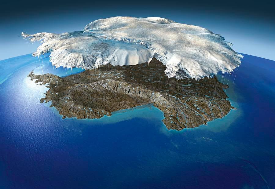
Because under kilometres of ice, Antarctica is not simply empty.
Rather, it is structured.
And in some regions, it appears unexpectedly complex.
A Frozen Continent with Two Competing Narratives
Scientific research describes Antarctica as a frozen record of Earth’s history shaped by millions of years of climate change.
After This… Israel Will Accept Jesus As Their Messiah!
Meanwhile, radar and satellite systems have mapped buried mountains, valleys, and subglacial lakes beneath the ice sheet.
However, alternative researchers interpret some of the same datasets differently.
Importantly, they do not change the data itself.
Instead, they question what it might represent at a larger scale.
On one side, scientists see geology and long-term planetary evolution.
On the other side, some observers see patterns that feel incomplete under current interpretation models.
Although both sides agree that a vast hidden landscape exists, they diverge on meaning.
The Hidden Architecture beneath the Ice
Ice-penetrating radar and satellite imaging now allow scientists to map what lies beneath Antarctica’s frozen surface.
Each signal travels through ice and reflects off structures below, creating a detailed image of the terrain underneath.
So far, researchers have identified:
- Entire mountain ranges buried beneath kilometres of ice
- Deep valleys carved by ancient river systems
- Extensive sediment layers spanning millions of years
- Large geological formations shaped by tectonic activity
Scientists interpret these features through established processes such as plate movement, erosion, and long-term climate shifts.
However, as resolution improves, the subsurface map becomes more detailed rather than simpler.
In some regions, structures also appear highly organised at large scale.
Even so, they are still explained through natural geological formation.
Subglacial Lakes and Isolated Systems
Beneath the ice, another hidden layer exists—water.
For example, Lake Vostok sits under nearly four kilometres of ice and remains sealed from the surface.
In addition, dozens of similar subglacial lakes have been identified across Antarctica.
Some of them appear completely isolated.
Others, however, show signs of possible hidden connections beneath the ice sheet.
Scientists study these environments as extreme natural laboratories.
In particular, they may preserve ancient microbial life or chemical conditions from early Earth.
Meanwhile, alternative commentary, including discussions by researchers such as Linda Moulton Howe, highlights the scale and distribution of these systems as something still not fully understood in broader interpretation.
Nevertheless, these interpretations remain speculative and are not part of established scientific conclusions.
Signals beneath the Ice That Require Careful Interpretation
Ice-penetrating radar remains the primary tool for mapping Antarctica’s interior.
In most regions, the data appears stable and consistent with known geological formations.
However, in some areas, the signals become more complex.
For instance, certain reflections appear unusually sharp.
In other cases, layers require repeated scanning before researchers confirm interpretation.
Scientists generally attribute these variations to ice density changes, buried rock structures, and natural signal distortion caused by extreme conditions.
This explanation remains the scientific consensus.
Nevertheless, Antarctica is still one of the least directly verified environments on Earth.
Therefore, large regions have not yet been physically sampled at depth.
As a result, interpretation still relies heavily on remote sensing.
Why Antarctica Invites Competing Interpretations
Antarctica’s isolation strongly influences how it is understood.
Because most of the continent cannot be directly accessed, scientists rely on satellites and radar systems rather than ground-level exploration.
Consequently, a gap exists between measurement and confirmation.
In mainstream science, this gap is treated as a technical limitation.
By contrast, alternative discussions often view it as a space where interpretation becomes less certain.
For example, commentary from figures like Linda Moulton Howe has brought attention to Antarctica within broader discussions of unexplained or debated phenomena.
However, no verified scientific evidence supports claims of artificial structures or unknown civilizations beneath the ice.
Instead, these ideas remain part of public discourse rather than established research.
What Scientists Actually Agree On
Despite differences in interpretation, scientists agree on several core findings.
- Antarctica contains a vast and highly complex landscape beneath its ice sheet
- The continent has undergone extreme climate transformation over millions of years
- Subglacial lakes are widespread and may preserve biological or chemical signals
- Large areas remain only partially mapped at high resolution
Each new dataset refines existing knowledge.
At the same time, it does not simplify Antarctica.
Instead, it adds more depth, structure, and detail.
Final Thoughts
Antarctica does not reveal itself quickly.
Rather, it reveals itself in layers through gradual advances in technology and analysis.
What once appeared as an empty white continent is now understood as a structured environment shaped by deep geological time.
Even so, large sections remain only partially resolved.
Not because nothing exists beneath the ice, but because not everything has yet been fully observed.
Ultimately, this leads to one final question:
As science continues refining its view of Antarctica, and alternative interpretations continue questioning its limits, what else might still be waiting in the parts of the continent we have not yet fully mapped?
 Watch the Video
What if the structures hidden beneath Antarctica are not just geological formations, but clues that our understanding of the continent is still incomplete?