
New Discovery of Ancient Symbols In Antarctica — Linda Moulton Howe
Deep beneath Antarctica’s ice, reported symbols have reignited debate over ancient presence and possible non-human influence in Earth’s past recorded human history.
Across Antarctica’s frozen interior, where ice sheets conceal bedrock that has not been directly seen for millions of years, unusual formations visible in satellite imagery have continued to attract attention from independent researchers and alternative investigators. Among them, journalist Linda Moulton Howe has referenced reports suggesting that certain patterns may resemble structured markings embedded within the ice landscape.
Mainstream polar science, however, approaches such claims through a different lens. Antarctica is one of the most intensively monitored environments on Earth from orbit, yet one of the least physically accessible on the ground. This creates a constant tension between what satellites appear to show and what can be physically verified.
Within that gap, interpretations diverge. Some view these formations as geological expressions of ice dynamics and fracture systems. Others suggest they may hint at deeper, older processes—possibly even predating known human history.
What remains consistent across disciplines is uncertainty at the visual edge of resolution, where ice, shadow, and compression artefacts can transform natural terrain into perceived structure.
Satellite Signals Reveal Unusual Surface Geometry

Modern Earth-observing satellites such as Landsat and Sentinel routinely scan Antarctica to track ice movement, elevation change, and climate indicators. These datasets often reveal long linear ridges, intersecting fractures, and repeating surface textures across vast ice plains.
Joe Rogan Just Announced The Shocking Truth About Antarctica That Terrifies The Whole World
In scientific interpretation, these features are understood as stress responses within moving ice sheets. However, when viewed outside geophysical context, they can appear unusually ordered or structured.
Image enhancement and contrast adjustments, common in public circulation, can further intensify these patterns, making natural formations appear more deliberate than they are.
Linda Moulton Howe and Alternative Interpretations
Linda Moulton Howe has highlighted Antarctic imagery within a broader investigative framework that includes unexplained aerial phenomena and environmental anomalies. Her focus has often been on questions that sit at the edge of conventional scientific interpretation.
In this context, Antarctic surface patterns have been discussed alongside broader hypotheses involving unknown activity or ancient presence beneath the ice.
Scientific institutions, however, treat such interpretations as speculative unless supported by direct sampling or peer-reviewed data. Antarctic research instead relies on radar sounding, ice-core drilling, and seismic mapping.
The difference reflects two parallel approaches: observational anomaly interpretation versus controlled geophysical validation.
Lost Civilisation Hypotheses beneath Ice Sheets
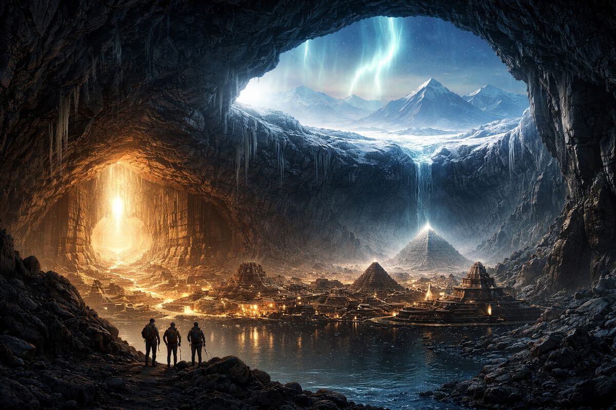
Among fringe interpretations, one recurring idea suggests that ıcy continent may preserve remnants of an ancient, pre-glacial civilisation buried beneath its ice sheet. This hypothesis is often linked to perceive geometric surface features and unexplained alignments.
From a geological standpoint, Antarctica’s ice coverage has persisted for millions of years in its current form, making surface-level preservation of structured human construction highly unlikely without extensive geological disruption.
However, proponents of alternative theories argue that undiscovered subglacial landscapes could still contain unknown formations, especially in regions that have never been directly accessed by drilling or excavation.
Scientific surveys beneath the ice have revealed mountain ranges, ancient river valleys, and lakes, reshaping understanding of Antarctica’s hidden terrain, though none indicate artificial origin.
Subglacial Mapping Reveals Hidden Landscapes
Radar and ice-penetrating satellite missions have uncovered a complex subglacial world beneath Antarctica’s ice sheet. These include deep basins, mountain systems, and ancient geological formations preserved under kilometres of ice.
This hidden topography plays a major role in shaping surface ice movement and fracture patterns observed from orbit. Variations in bedrock elevation can influence how ice flows, creating linear stress zones at the surface.
Such processes are well documented in glaciology and are central to explaining many of the patterns visible in satellite imagery.
While visually striking, these features are consistent with known Earth system dynamics rather than external construction.
UFO Narratives Enter Antarctic Discussion
As Antarctic anomalies gained visibility online, some interpretations expanded into UFO-related narratives. These suggest that unusual surface formations or subglacial structures could be linked to non-human intelligence or unknown technological activity.
These ideas are often amplified in digital communities where imagery is enhanced, reinterpreted, and circulated without scientific metadata.
Despite their popularity, no verified scientific evidence supports extraterrestrial involvement in Antarctic geology or ice structures. Observed anomalies are consistently explainable through environmental and imaging processes.
Still, the association persists, largely driven by Antarctica’s remoteness and the scale of what remains unseen beneath its ice.
Ice Sheet Dynamics Explain Repeating Patterns
Antarctica’s ice sheet is not static but in constant motion, flowing slowly over bedrock under immense pressure. This movement generates predictable stress fields that can produce repeating linear or angular patterns on the surface.
Wind erosion and seasonal temperature shifts further modify surface texture, reinforcing the appearance of structure when viewed from orbit.
In combination, these processes can create visual effects that resemble engineered geometry, particularly in low-resolution or high-contrast imagery.
Glaciologists emphasize that such patterns are expected outcomes of physical systems operating over long timescales.
Scientific Exploration of Subglacial Antarctica
International research programs continue to map Antarctica using satellites, autonomous sensors, and ice-penetrating radar systems. These efforts have significantly expanded understanding of what lies beneath the ice sheet.
Discoveries include ancient river systems and isolated subglacial lakes, demonstrating that the continent preserves a dynamic geological history largely hidden from direct view.
However, no evidence has been found indicating artificial structures, lost civilisations, or non-terrestrial activity within these environments.
Scientific consensus remains grounded in observable geological processes, even as remote imagery continues to fuel alternative interpretations.
Antarctica Remains a Deep Scientific Frontier
Despite decades of research, Antarctica remains one of Earth’s least physically explored continents. Much of its interior is studied indirectly through remote sensing rather than direct excavation.
This limitation naturally leaves gaps in perception, where incomplete data can be interpreted in multiple ways depending on analytical framework.
For science, these gaps represent targets for future exploration and measurement. For alternative investigators, they represent space for unanswered questions.
Between those perspectives, Antarctica continues to exist as both a mapped physical system and a landscape of enduring speculation.
 Watch This:
Could Antarctica’s strange satellite patterns be evidence of a lost civilisation or something even older buried beneath the ice?